

Google is significantly upgrading its Maps experience in India by integrating Gemini-powered insights and partnering with the National Highways Authority of India (NHAI) to deliver real-time road data and enhanced safety notifications.
Real-Time Infrastructure Integration
Through its new collaboration with the NHAI, Google Maps will now receive near real-time updates regarding road closures, diversions, and ongoing repair projects. Beyond traffic management, this integration allows the platform to display critical wayside amenities—including public restrooms, restaurants, and fuel stations—directly along national highways.
Proactive Alerts and Speed Monitoring
Google is introducing proactive notifications for major travel disruptions, alerting users to delays on their routes even when active turn-by-turn navigation is not engaged. These alerts are currently rolling out to Android users covering highways and major roads in New Delhi, Mumbai, and Bengaluru.
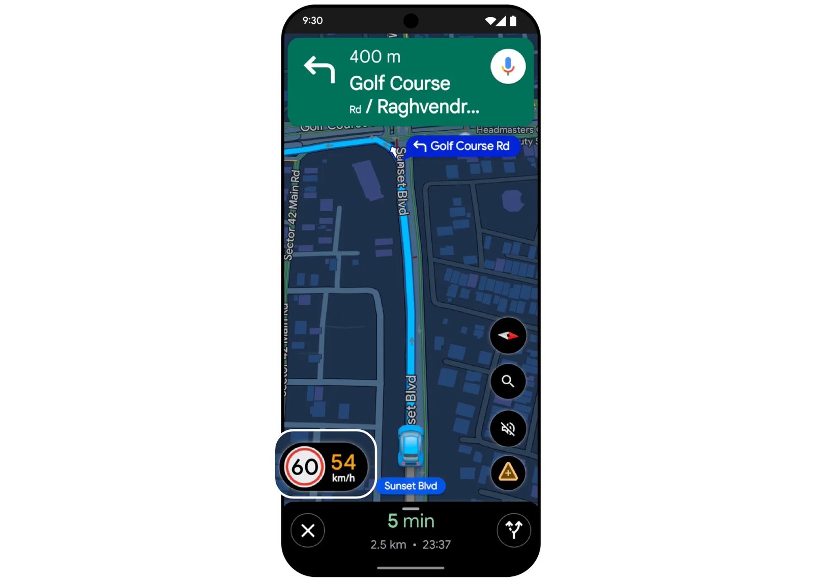
Additionally, the application will now display local speed limits during navigation, utilizing data provided by regional traffic authorities. This functionality is being deployed for both Android and iOS users across nine cities: Faridabad, Ghaziabad, Gurugram, Hyderabad (including Cyberabad), Jaipur, Kolkata, Lucknow, Mumbai, and Noida.
Advanced Flyover Navigation
Expanding on the flyover navigation feature introduced last year, Google Maps is now adding voice support specifically for flyovers. This update is scheduled to reach Android and iOS users over the coming weeks, further refining the guidance provided in complex urban driving environments.